Watford: The Flag public house
Introduction
The photograph on this page of Watford: The Flag public house by Nigel Cox as part of the Geograph project.
The Geograph project started in 2005 with the aim of publishing, organising and preserving representative images for every square kilometre of Great Britain, Ireland and the Isle of Man.

There are currently over 7.5m images from over 14,400 individuals and you can help contribute to the project by visiting https://www.geograph.org.uk
Watford: The Flag public house
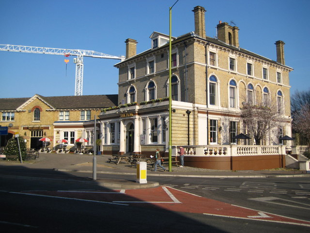
Image: © Nigel Cox Taken: 16 Feb 2008
This attractive building was originally the Clarendon Hotel, built in Station Road in 1860 to serve travellers using the nearby Watford Junction railway station. A comparison with a drawing of the building made in 1862 shows that little has changed in the intervening 146 years! It eventually became a Benskins public house known as The Pennant, but subsequently was rebranded as The Flag and Firkin, finally dropping the Firkin name. For some time the forecourt outside the building, to the left, was used as the bus terminus for the railway station. The building to the left formerly housed the hotel's stables. The building is Grade II listed.
Images are licensed for reuse under creativecommons.org/licenses/by-sa/2.0
Image Location
Latitude
51.663547
Longitude
-0.397962