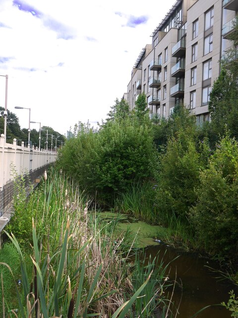
Counters Creek (or the Kensington Canal?) by West Brompton station
Introduction
The photograph on this page of Counters Creek (or the Kensington Canal?) by West Brompton station by Stefan Czapski as part of the Geograph project.
The Geograph project started in 2005 with the aim of publishing, organising and preserving representative images for every square kilometre of Great Britain, Ireland and the Isle of Man.
There are currently over 7.5m images from over 14,400 individuals and you can help contribute to the project by visiting https://www.geograph.org.uk

Image: © Stefan Czapski Taken: 13 Aug 2021
Leaving West Brompton station after travelling for the very first time on the West London line, I looked over my shoulder and noticed this body of water and the old seed-heads of reed mace - bullrushes. As a schoolboy I had (for seven years) travelled into town on the District Line, and in those days there were railway sidings here - where the tall block of flats now stands. I'd never suspected that there was a watercourse here, between the station and sidings - there hardly seemed to be room. As for the identity of this body of water, Geograph came to the rescue - in the person of Christopher Hilton. He doesn't seem to have seen this stretch of water, but spotted the remains of a bridge a little further north. Image He also suggests that the same watercourse is known as Chelsea Creek where it reaches the Thames: Image A quick look at a map or two suggests that the boundary between the old boroughs of Fulham (to the west) and Kensington and Chelsea runs along Counters Creek from here right down to the Thames. It's a hypothesis I need to look at in more detail. Incidentally, along the Thames the name 'creek' generally denotes a tidal tributary. It's a bizarre thought, but is it possible that the tide once flowed under the Old Brompton Road?

