
Estate Boundary Marker on Kerrow Downs in Blisland parish
Introduction
The photograph on this page of Estate Boundary Marker on Kerrow Downs in Blisland parish by P G Moore as part of the Geograph project.
The Geograph project started in 2005 with the aim of publishing, organising and preserving representative images for every square kilometre of Great Britain, Ireland and the Isle of Man.

There are currently over 7.5m images from over 14,400 individuals and you can help contribute to the project by visiting https://www.geograph.org.uk
Estate Boundary Marker on Kerrow Downs in Blisland parish
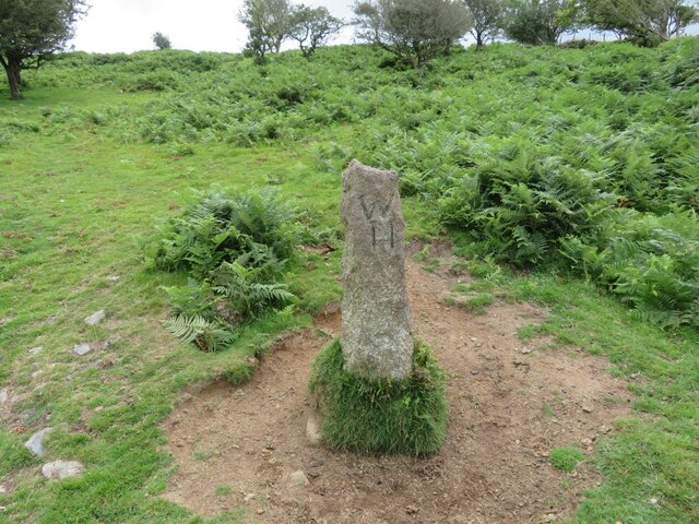
Image: © P G Moore Taken: Unknown
Estate Boundary Marker adjacent to the boundary wall at the northwest corner of the enclosed farmland of North Kerrow Farm on the north facing slope of the open moorland of Kerrow Downs. Blisland parish. The 1842 Tithe map shows a series of stones separating Kerrow Downs and Penquite Marsh from an area to the north known formerly as Black Downs or Blackpool. With the exception of one stone, now thought to be used as a gatepost to a field to the east, all these survive, although Black Downs is now simply known as part of Kerrow Downs. Records show that Sir William Molesworth was in 1842 the Lord of the Manor of Blisland and owned Kerrow Downs and part of Penquite Marsh. His mark MX is carved on the southern face of this stone. Records also show that Black Downs was at this time owned by John Wallis and his mark W is carved on the stone’s northern face. Subsequently Black Downs was acquired by James Hayward, and his letter H was added to this stone at a later date. Milestone Society National ID: CW_BLIS47em
Images are licensed for reuse under creativecommons.org/licenses/by-sa/2.0
Image Location

Latitude
50.526608
Longitude
-4.664511