Flush Bracket near Draperstown
Introduction
The photograph on this page of Flush Bracket near Draperstown by Rossographer as part of the Geograph project.
The Geograph project started in 2005 with the aim of publishing, organising and preserving representative images for every square kilometre of Great Britain, Ireland and the Isle of Man.

There are currently over 7.5m images from over 14,400 individuals and you can help contribute to the project by visiting https://www.geograph.org.uk
Flush Bracket near Draperstown
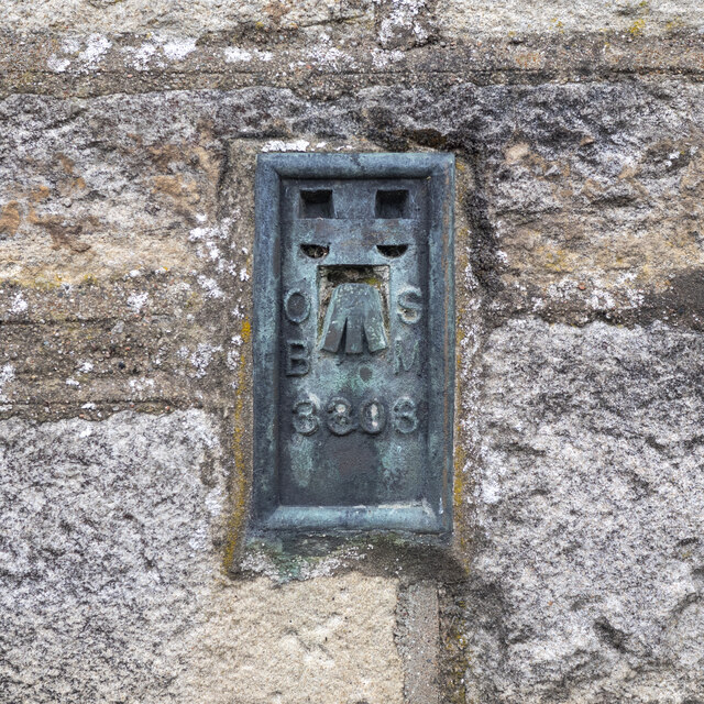
Image: © Rossographer Taken: 14 Aug 2021
Flush bracket bench mark on the northern wall of St Columba's RC church at Straw, south of Draperstown Image The number on the bracket is OSBM 3303. The mark has been levelled to 88.63m above MSL.
Images are licensed for reuse under creativecommons.org/licenses/by-sa/2.0
Image Location
Latitude
54.782684
Longitude
-6.807345