
"Archaeology Around Westgate" Information Board
Introduction
The photograph on this page of "Archaeology Around Westgate" Information Board by David Hillas as part of the Geograph project.
The Geograph project started in 2005 with the aim of publishing, organising and preserving representative images for every square kilometre of Great Britain, Ireland and the Isle of Man.

There are currently over 7.5m images from over 14,400 individuals and you can help contribute to the project by visiting https://www.geograph.org.uk
"Archaeology Around Westgate" Information Board
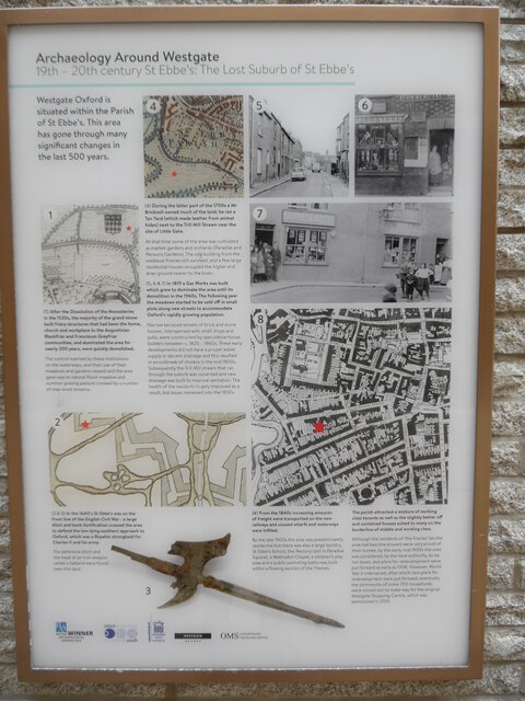
Image: © David Hillas Taken: 12 Aug 2021
This information board is in Bridge Street off Speedwell Street and has the following wording: Archaeology Around Westgate 19th-20th century St Ebbe's: the Lost Suburb of St Ebbe's First column Westgate Oxford is situated within the Parish of St Ebbe's. This area has gone through many significant changes in the last 500 years. Map 1) After the Dissolution of the Monasteries in the 1530s, the majority of the grand stone-built friary structures that had been the home, church and workplace to the Augustinian Blackfriar and Franciscan Greyfriar communities, and dominated the area for nearly 300 years, were quickly demolished. The control exerted by these institutions on the waterways, and their use of their meadows and gardens ceased and the area gave way to natural flood- meadow and summer grazing pasture crossed by a number of tree-lined streams. Map 2) (2&3) In the 1640s St Ebbe's was on the front line of the English Civil War- a large ditch and bank fortification crossed the area to defend the low-lying southern approach to Oxford, which was a Royalist stronghold for Charles II and his army. The defensive ditch and the head of an iron weapon called a halberd were found near this spot. Drawing 3) Second Column Map 4) (4) During the latter part of the 1700s, a Mr Bricknell owned much of the land; he ran a Tan Yard (which made leather from animal hides) next to the Trill Mill Stream near the site of Little Gate. At that time some of the area was cultivated as market gardens and orchards (Paradise and Pensons Gardens). The odd building from the medieval friaries still survived, and a few large residential houses occupied the higher and drier ground nearer to the town. (5,6&7) In 1819 a Gas Works was built which grew to dominate the area until its demolition in the 1960s. The following year the meadows started to be sold off in small plots along new streets to accommodate Oxford's rapidly growing population. Narrow terraced streets of brick and stone houses, interspersed with small shops and pubs, were constructed by speculative house builders between c.1820-1860s. These early developments did not have a proper water supply or decent drainage and this resulted in an outbreak of cholera in the mid 1800s. Subsequently the Trill Mill stream that ran through the suburb was culverted and new drainage was built to improve sanitation. The health of the residents hugely improved as a result, but issues remained into the 1930s. Map 2) Third Column Photo 5) Photo 7) Map 8) (8) From the 1840s increasing amounts of freight were transported on the new railways and unused wharfs and waterways were infilled. By the late 1900s, the area was predominantly residential but there was also a large laundry, St Ebbe's School, the Rectory (still in Paradise Square), a Methodist Chapel, a children's play area and a public swimming baths was built within a flowing section of the Thames. Fourth Column Photo 6) Photo 7) Map 8) The parish attracted a mixture of working class tenants as well as the slightly better off and contained houses suited to many on the borderline of middle and working class. Although the residents of 'the friaries' (as the area had become known) were very proud of their homes, by the early-mid 1900s the area was considered by the local authority to be run down, and plans for redevelopment were put forward as early as 1938. However, World War II intervened after which new plans for redevelopment were put forward. Eventually the community of some 700 households were moved out to make way for the original Westgate Shopping Centre, which was demolished in 2015.
Images are licensed for reuse under creativecommons.org/licenses/by-sa/2.0
Image Location

Latitude
51.74867
Longitude
-1.262221