Lowbands
Introduction
The photograph on this page of Lowbands by Bob Embleton as part of the Geograph project.
The Geograph project started in 2005 with the aim of publishing, organising and preserving representative images for every square kilometre of Great Britain, Ireland and the Isle of Man.

There are currently over 7.5m images from over 14,400 individuals and you can help contribute to the project by visiting https://www.geograph.org.uk
Lowbands
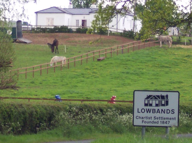
Image: © Bob Embleton Taken: 3 May 2005
The Chartist, or National, Land Company was founded in 1845 to establish families from the factory towns on smallholdings, where they could maintain themselves and qualify for a vote.
Images are licensed for reuse under creativecommons.org/licenses/by-sa/2.0
Image Location


Leaflet Map data © OpenStreetMap
Latitude
51.9815
Longitude
-2.329012