Estate Boundary Marker on Metherin Downs in Blisland parish
Introduction
The photograph on this page of Estate Boundary Marker on Metherin Downs in Blisland parish by P G Moore as part of the Geograph project.
The Geograph project started in 2005 with the aim of publishing, organising and preserving representative images for every square kilometre of Great Britain, Ireland and the Isle of Man.

There are currently over 7.5m images from over 14,400 individuals and you can help contribute to the project by visiting https://www.geograph.org.uk
Estate Boundary Marker on Metherin Downs in Blisland parish
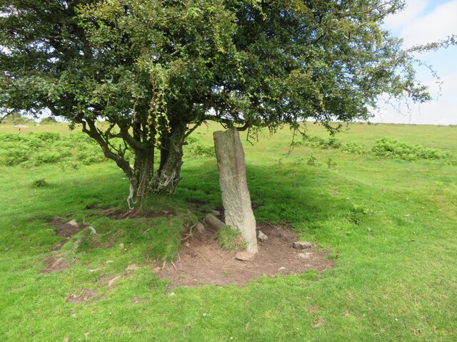
Image: © P G Moore Taken: Unknown
Estate Boundary Marker on open moorland beside the remains of a boundary bank that traverses Metherin Downs 130 metres south of the lane from Moss Farm to North Kerrow. Blisland parish. One of two stones that appear to mark the boundary of the commons of Kerrow Downs to the north and Metherin Downs to the south. The letter M on its southern face indicates that Metherin Downs was owned by Sir William Molesworth. At this time the adjacent Kerrow Downs was also owned by Molesworth, so it is possible that this boundary was used to assess the common rights apportioned to the lessees of each individual area of common land. Milestone Society National ID: CW_BLIS42em
Images are licensed for reuse under creativecommons.org/licenses/by-sa/2.0
Image Location


Leaflet Map data © OpenStreetMap
Latitude
50.541679
Longitude
-4.662707