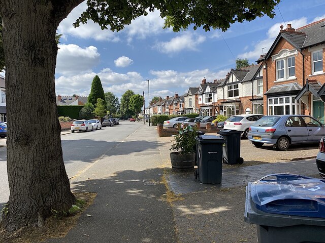
South on Green Lanes, Wylde Green, north Birmingham
Introduction
The photograph on this page of South on Green Lanes, Wylde Green, north Birmingham by Robin Stott as part of the Geograph project.
The Geograph project started in 2005 with the aim of publishing, organising and preserving representative images for every square kilometre of Great Britain, Ireland and the Isle of Man.
There are currently over 7.5m images from over 14,400 individuals and you can help contribute to the project by visiting https://www.geograph.org.uk

Image: © Robin Stott Taken: 14 Jul 2021
These were the first suburban houses on Green Lanes, dating from the Edwardian years. It was solidly built up with detached and semi-detached houses by 1937, going by old-maps.co.uk. The south end of Green Lanes had been severed by the L & NWR's Sutton Coldfield Branch: the necessary realignment gave the slight change of direction of the road, seen in the distance. Big old trees tell of an earlier undeveloped suburb when much of Green Lanes was a country lane between fields and allotment gardens.

