After the flood
Introduction
The photograph on this page of After the flood by Richard Sutcliffe as part of the Geograph project.
The Geograph project started in 2005 with the aim of publishing, organising and preserving representative images for every square kilometre of Great Britain, Ireland and the Isle of Man.

There are currently over 7.5m images from over 14,400 individuals and you can help contribute to the project by visiting https://www.geograph.org.uk
After the flood
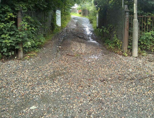
Image: © Richard Sutcliffe Taken: 10 Aug 2021
The entrance to Garscube Allotments on Maryhill Road. Torrential rain the previous day had seen large volumes of water pouring down the slope out of the allotments, eroding the track and depositing a significant amount of gravel from it onto the road and pavement.
Images are licensed for reuse under creativecommons.org/licenses/by-sa/2.0
Image Location
Latitude
55.901613
Longitude
-4.308772