Flooded road
Introduction
The photograph on this page of Flooded road by Richard Sutcliffe as part of the Geograph project.
The Geograph project started in 2005 with the aim of publishing, organising and preserving representative images for every square kilometre of Great Britain, Ireland and the Isle of Man.

There are currently over 7.5m images from over 14,400 individuals and you can help contribute to the project by visiting https://www.geograph.org.uk
Flooded road
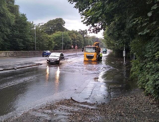
Image: © Richard Sutcliffe Taken: 10 Aug 2021
Council workers attempting to clear the drains on the A81, Maryhill Road, after the road had flooded. This photograph was taken about 24 hours after the road had flooded due to a torrential downpour which affected a wide area of northwest Glasgow, Bearsden and Milngavie. Most of the other floods on other roads had drained away, but this one was obviously causing a problem. Vehicles heading for Glasgow were having to go through several inches of water and many were driving half on the central reservation of the dual carriageway.
Images are licensed for reuse under creativecommons.org/licenses/by-sa/2.0
Image Location
Latitude
55.901787
Longitude
-4.309102