The Hemlock Stone
Introduction
The photograph on this page of The Hemlock Stone by Alan Murray-Rust as part of the Geograph project.
The Geograph project started in 2005 with the aim of publishing, organising and preserving representative images for every square kilometre of Great Britain, Ireland and the Isle of Man.

There are currently over 7.5m images from over 14,400 individuals and you can help contribute to the project by visiting https://www.geograph.org.uk
The Hemlock Stone
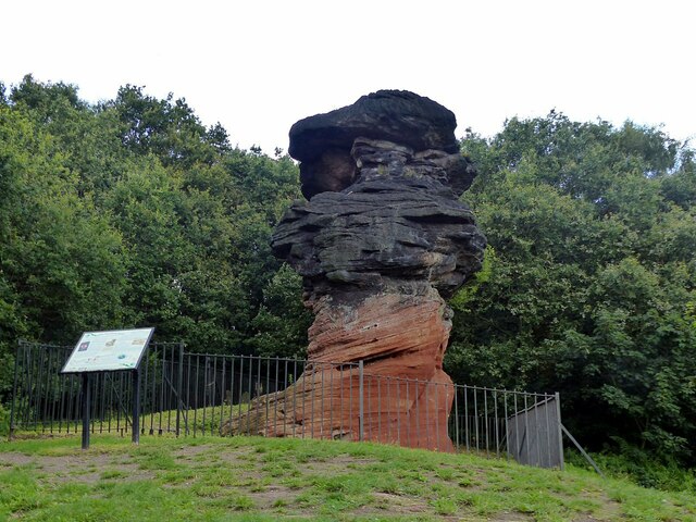
Image: © Alan Murray-Rust Taken: 9 Aug 2021
Almost recreating this 'First' for the square https://www.geograph.org.uk/photo/17658 . The position of the notice board relative to the rock shows that this is not taken from exactly the same position. This view http://www.geograph.org.uk/photo/6928773 shows the result of doing so. This outcrop is what is known as an inselberg, the result of differential erosion. The waisted form is the result of the upper layers being a slightly harder material which has weathered less. Both layers form part of the Nottingham Castle Sandstone group, but are of slightly different ages.
Images are licensed for reuse under creativecommons.org/licenses/by-sa/2.0
Image Location
Latitude
52.943013
Longitude
-1.258145