Cornel Bach standing stones, Maenclochog
Introduction
The photograph on this page of Cornel Bach standing stones, Maenclochog by Natasha Ceridwen de Chroustchoff as part of the Geograph project.
The Geograph project started in 2005 with the aim of publishing, organising and preserving representative images for every square kilometre of Great Britain, Ireland and the Isle of Man.

There are currently over 7.5m images from over 14,400 individuals and you can help contribute to the project by visiting https://www.geograph.org.uk
Cornel Bach standing stones, Maenclochog
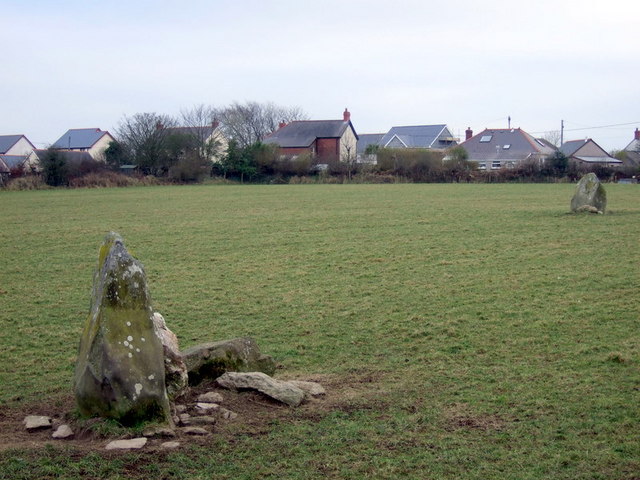
Image: © Natasha Ceridwen de Chroustchoff Taken: 15 Feb 2008
Two standing stones in a field behind the main village street. The one in the foreground here stands close to the hedge with the further stone positioned to the northeast of it. It has been suggested that these stones once formed the 'cromlech' (or burial chamber) which local people blew up with gunpowder in the C18, and which also gave the village its name: ringing stone. Cornel Bach means little corner.
Images are licensed for reuse under creativecommons.org/licenses/by-sa/2.0
Image Location


Leaflet Map data © OpenStreetMap
Latitude
51.915804
Longitude
-4.789638