Unitarian Church
Introduction
The photograph on this page of Unitarian Church by Andy Potter as part of the Geograph project.
The Geograph project started in 2005 with the aim of publishing, organising and preserving representative images for every square kilometre of Great Britain, Ireland and the Isle of Man.

There are currently over 7.5m images from over 14,400 individuals and you can help contribute to the project by visiting https://www.geograph.org.uk
Unitarian Church
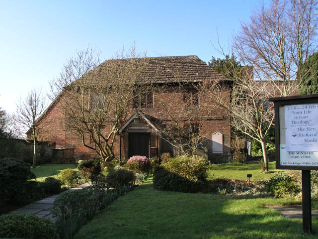
Image: © Andy Potter Taken: 16 Feb 2008
Horsham's second oldest surviving church it was built in 1721 to resemble a two-storey house and was set back from the road to avoid drawing unwanted attention at a time when religious non-conformity was a criminal offence. Horsham's first public library was housed in the hall of the church and Horsham's Museum Society started here. For more information see Horsham Unitarian Church http://www.unitarian.org.uk/ldpa/horsham/#history and the excellent Hidden Horsham http://www.hiddenhorsham.co.uk/41/unitarian.htm.
Images are licensed for reuse under creativecommons.org/licenses/by-sa/2.0
Image Location


Leaflet Map data © OpenStreetMap
Latitude
51.062847
Longitude
-0.333301