County Bridge Marker on the B6265, Grassington
Introduction
The photograph on this page of County Bridge Marker on the B6265, Grassington by P Robertson as part of the Geograph project.
The Geograph project started in 2005 with the aim of publishing, organising and preserving representative images for every square kilometre of Great Britain, Ireland and the Isle of Man.

There are currently over 7.5m images from over 14,400 individuals and you can help contribute to the project by visiting https://www.geograph.org.uk
County Bridge Marker on the B6265, Grassington
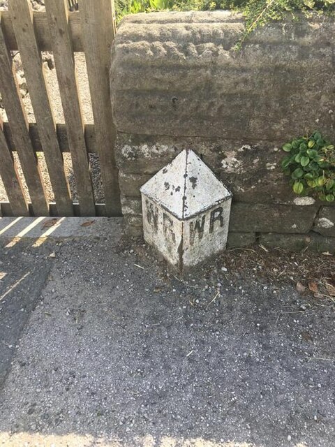
Image: © P Robertson Taken: 3 Aug 2021
County Bridge Marker against a stone garden wall on the south side of the B6265 Station Road east of Grassington Bridge, River Wharfe. Grassington parish. The casting marks the extent of roadway adjoining the bridge that the County was obliged to maintain. Milestone Society National ID: YW_GRASS07br
Images are licensed for reuse under creativecommons.org/licenses/by-sa/2.0
Image Location
Latitude
54.070746
Longitude
-2.003067