Part of the Information Board in Windsor High Street (3)
Introduction
The photograph on this page of Part of the Information Board in Windsor High Street (3) by David Hillas as part of the Geograph project.
The Geograph project started in 2005 with the aim of publishing, organising and preserving representative images for every square kilometre of Great Britain, Ireland and the Isle of Man.

There are currently over 7.5m images from over 14,400 individuals and you can help contribute to the project by visiting https://www.geograph.org.uk
Part of the Information Board in Windsor High Street (3)
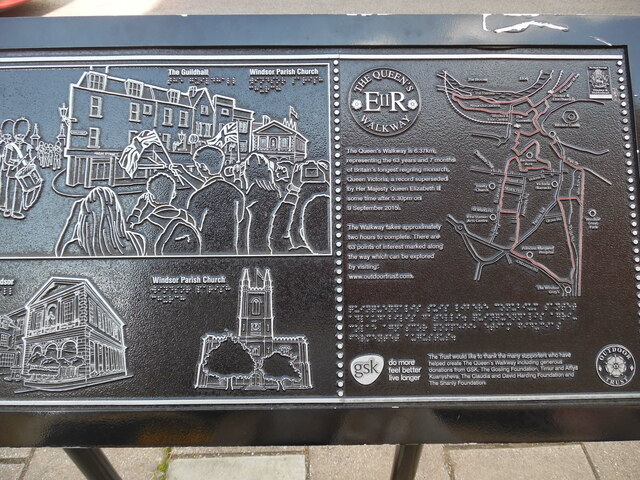
Image: © David Hillas Taken: 29 Jul 2021
This photo shows the right hand side of the information board in the High Street near Peascod Street. The left half has illustrations of The Guildhall and Windsor Parish Church with people waving their Union Jack flags and taking photos. On the right half is a map of The Queen's Walkway in Windsor with the following wording: The Queen's Walkway is 6.37km, representing the 63 years and 7 months of Britain's longest reigning monarch, Queen Victoria, a record superseded by Her Majesty Queen Elizabeth II some time after 5.30pm on 9 September 2015. The Walkway takes approximately two hours to complete. There are 63 points of interest marked along the way which can be explored by visiting www.outdoortrust.com. The wording below the map mentions The Outdoor Trust who would like to thank the many supporters who have helped create The Queen's Walkway including generous donations. Incidentally, 6.37km is 3.96 miles in imperial measurement.
Images are licensed for reuse under creativecommons.org/licenses/by-sa/2.0
Image Location
Latitude
51.482247
Longitude
-0.607819