Cheltenham features [51]
Introduction
The photograph on this page of Cheltenham features [51] by Michael Dibb as part of the Geograph project.
The Geograph project started in 2005 with the aim of publishing, organising and preserving representative images for every square kilometre of Great Britain, Ireland and the Isle of Man.

There are currently over 7.5m images from over 14,400 individuals and you can help contribute to the project by visiting https://www.geograph.org.uk
Cheltenham features [51]
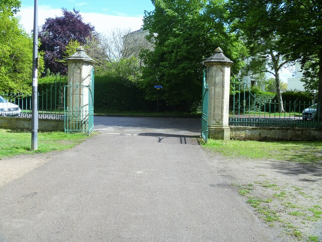
Image: © Michael Dibb Taken: 19 May 2021
From Pittville Park, these gates lead to Pittville Lawn. Erected circa 1835, with ashlar piers and wrought-iron gates. Listed, grade II, with details at: https://historicengland.org.uk/listing/the-list/list-entry/1387481 The Pump Room, roads and gardens of the Pittville Estate were purchased by Cheltenham Borough Council in 1891 and opened as a public park. The park is on the Register of Historic Parks and Gardens, grade II, with details at: https://historicengland.org.uk/listing/the-list/list-entry/1000196 Cheltenham is located at the foot of the Cotswold scarp with the small River Chelt flowing through the town. After the discovery of mineral springs in 1716 Cheltenham became a spa town and many Regency houses and other buildings were erected. The town is home to the renowned Cheltenham Festival, four days of horse jump racing culminating in the Gold Cup, held annually in March at the nearby racecourse.
Images are licensed for reuse under creativecommons.org/licenses/by-sa/2.0
Image Location


Leaflet Map data © OpenStreetMap
Latitude
51.909205
Longitude
-2.067549