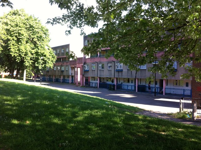
Maisonettes, Upper Spon Street, Spon End, Coventry
Introduction
The photograph on this page of Maisonettes, Upper Spon Street, Spon End, Coventry by A J Paxton as part of the Geograph project.
The Geograph project started in 2005 with the aim of publishing, organising and preserving representative images for every square kilometre of Great Britain, Ireland and the Isle of Man.
There are currently over 7.5m images from over 14,400 individuals and you can help contribute to the project by visiting https://www.geograph.org.uk

Image: © A J Paxton Taken: 12 Jun 2021
Spon End was an early suburb of Coventry that developed along the road to Birmingham beyond the Spon Gate on the western side of the city. It became a quarter of tanners and dyers, who used the waters of the River Sherbourne; by the 19th century watchmaking had also become important. https://en.wikipedia.org/wiki/Spon_Street Spon End became known as a slum; in the 1952 Development Plan for Coventry, the city's chief architect Donald Gibson wrote that it had “some of the worst housing conditions in the city… [with] the worst possible lightning [sic] and ventilation… Sanitary facilities are highly unsatisfactory.” https://sponend.wordpress.com/2018/08/06/buildings/ The planners' response was to compulsorily purchase and demolish most of the existing housing and replace it with a mixture of two-storey houses and low-rise and high-rise flats and maisonettes. Gibson's successor Arthur Ling modified the plan in 1957, favouring more high-rise housing. The Wimpey construction company completed the development in eight years in the 1960s, using the 'no-fines' construction method. These maisonettes are typical of the development. They have flat roofs, walkways connecting blocks at second floor level, and exterior walls of very plain unadorned concrete incised with vertical lines.

