
Spon Gates old & new
Introduction
The photograph on this page of Spon Gates old & new by A J Paxton as part of the Geograph project.
The Geograph project started in 2005 with the aim of publishing, organising and preserving representative images for every square kilometre of Great Britain, Ireland and the Isle of Man.

There are currently over 7.5m images from over 14,400 individuals and you can help contribute to the project by visiting https://www.geograph.org.uk
Spon Gates old & new
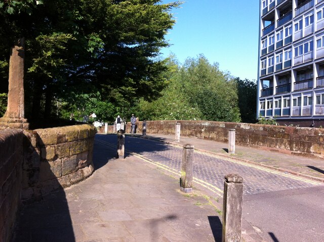
Image: © A J Paxton Taken: 12 Jun 2021
We are looking east along Upper Spon Street at the point where it is carried over the River Sherbourne by the Spon Bridge. The 13th century bridge was once the main approach to Coventry from the west. It was rebuilt in 1771 using some stone from the demolished medieval Spon Gate. https://historicengland.org.uk/listing/the-list/list-entry/1076603 To the right can be seen part of Spon Gate House, a 10-storey block of 52 flats built in 1960 for the city council to designs by Arthur Ling. https://www.towerblock.eca.ed.ac.uk/development/butts
Images are licensed for reuse under creativecommons.org/licenses/by-sa/2.0
Image Location

Latitude
52.40814
Longitude
-1.524845