Military Boundary Marker on the Corner of North Barrack Road and Campbell Road
Introduction
The photograph on this page of Military Boundary Marker on the Corner of North Barrack Road and Campbell Road by Sheila Harris as part of the Geograph project.
The Geograph project started in 2005 with the aim of publishing, organising and preserving representative images for every square kilometre of Great Britain, Ireland and the Isle of Man.

There are currently over 7.5m images from over 14,400 individuals and you can help contribute to the project by visiting https://www.geograph.org.uk
Military Boundary Marker on the Corner of North Barrack Road and Campbell Road
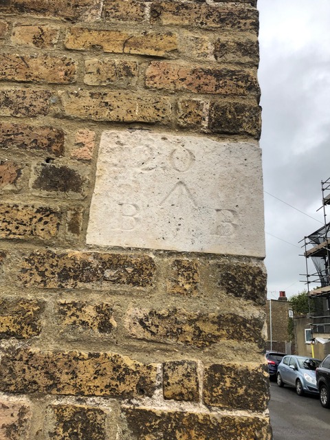
Image: © Sheila Harris Taken: 25 Jun 2021
On the angle of the former barracks postroom is military boundary marker. See https://www.geograph.org.uk/photo/6918490 for a wider view. Photo by Sheila Harris, with permission. Milestone Society National ID: KE_BBWALM01em
Images are licensed for reuse under creativecommons.org/licenses/by-sa/2.0
Image Location
Latitude
51.215642
Longitude
1.401538