Shops of Far Gosford Street, Coventry, on the south side at the eastern end
Introduction
The photograph on this page of Shops of Far Gosford Street, Coventry, on the south side at the eastern end by A J Paxton as part of the Geograph project.
The Geograph project started in 2005 with the aim of publishing, organising and preserving representative images for every square kilometre of Great Britain, Ireland and the Isle of Man.

There are currently over 7.5m images from over 14,400 individuals and you can help contribute to the project by visiting https://www.geograph.org.uk
Shops of Far Gosford Street, Coventry, on the south side at the eastern end
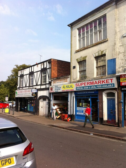
Image: © A J Paxton Taken: 24 Jul 2021
The Al Halal supermarket occupies the ground floor of a silk ribbon weaver's house, with its distinctive large top shop window maximising the fall of natural light on the handloom and the fine, detailed work that was carried out on it. The house dates probably from the first half of the 19th century - the trade collapsed after 1860 - but Far Gosford Street has a much longer history extending back to the middle ages, when it was an eastern suburb beyond the Gosford Gate and the city walls of Coventry. Beyond Al Halal is the B&T African supermarket. https://www.coventrysociety.org.uk/news/article/new-heritage-group-for-far-gosford-street.html
Images are licensed for reuse under creativecommons.org/licenses/by-sa/2.0
Image Location
Latitude
52.408099
Longitude
-1.49324