Ordnance Survey Cut Mark
Introduction
The photograph on this page of Ordnance Survey Cut Mark by Peter Wood as part of the Geograph project.
The Geograph project started in 2005 with the aim of publishing, organising and preserving representative images for every square kilometre of Great Britain, Ireland and the Isle of Man.

There are currently over 7.5m images from over 14,400 individuals and you can help contribute to the project by visiting https://www.geograph.org.uk
Ordnance Survey Cut Mark
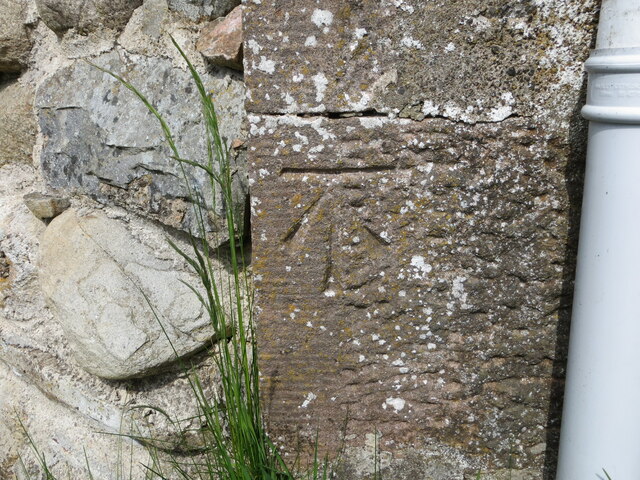
Image: © Peter Wood Taken: 1 Jun 2021
This mark can be found on the roadside wall of what was once a school building but now a private dwelling. The benchmark has a recorded height of 187.201 metres above sea level. For more detail see : https://www.bench-marks.org.uk/bm151957
Images are licensed for reuse under creativecommons.org/licenses/by-sa/2.0
Image Location


Leaflet Map data © OpenStreetMap
Latitude
57.414826
Longitude
-4.462725