The Defensible Barracks
Introduction
The photograph on this page of The Defensible Barracks by Arthur C Harris as part of the Geograph project.
The Geograph project started in 2005 with the aim of publishing, organising and preserving representative images for every square kilometre of Great Britain, Ireland and the Isle of Man.

There are currently over 7.5m images from over 14,400 individuals and you can help contribute to the project by visiting https://www.geograph.org.uk
The Defensible Barracks
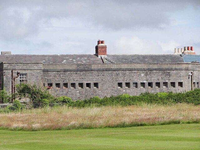
Image: © Arthur C Harris Taken: 12 Jul 2021
1841-6 defensible barracks, built to house officers and men of the Royal Marines, and, to a limited extent, to provide landward defence for the Royal Dockyard. A Grade II Listed Building
Images are licensed for reuse under creativecommons.org/licenses/by-sa/2.0
Image Location
Latitude
51.688089
Longitude
-4.955034