Dalton, High Bridge
Introduction
The photograph on this page of Dalton, High Bridge by Mel Towler as part of the Geograph project.
The Geograph project started in 2005 with the aim of publishing, organising and preserving representative images for every square kilometre of Great Britain, Ireland and the Isle of Man.

There are currently over 7.5m images from over 14,400 individuals and you can help contribute to the project by visiting https://www.geograph.org.uk
Dalton, High Bridge
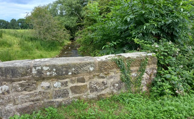
Image: © Mel Towler Taken: 13 Jul 2021
A wider angle showing the eastern parapet of High Bridge traversing Dalton Beck. This is located to the south of the village. On the 3rd stone from the extreme right there is a clear benchmark cut into the top of the stone.
Images are licensed for reuse under creativecommons.org/licenses/by-sa/2.0
Image Location
Latitude
54.469937
Longitude
-1.822528