Grange Farmhouse and barn in Coven, Staffordshire
Introduction
The photograph on this page of Grange Farmhouse and barn in Coven, Staffordshire by Roger Kidd as part of the Geograph project.
The Geograph project started in 2005 with the aim of publishing, organising and preserving representative images for every square kilometre of Great Britain, Ireland and the Isle of Man.

There are currently over 7.5m images from over 14,400 individuals and you can help contribute to the project by visiting https://www.geograph.org.uk
Grange Farmhouse and barn in Coven, Staffordshire
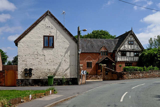
Image: © Roger Kidd Taken: 14 Jul 2021
Brewood Road meanders south-eastwards through the village and joins the A449 near Cross Green. On this bend is the late sixteenth century (Grade II listed) Grange Farmhouse. This has been altered greatly during recent modernisation e.g. chimneys have been removed and an unoriginal frontage facade removed. It is now called Grange Hall Farm. See 1999 image here: https://historicengland.org.uk/listing/the-list/list-entry/1344649 The barn on the left, and other farm buildings are also fully converted for residential use. https://www.search.staffspasttrack.org.uk/Details.aspx?&ResourceID=11199&PageIndex=5&SearchType=2&ThemeID=441 https://www.thefreelibrary.com/Rugby+player+tackles+a+rewarding+restoration%3B+Grange+Hall+Farm+seemed...-a0359453984
Images are licensed for reuse under creativecommons.org/licenses/by-sa/2.0
Image Location
Latitude
52.659115
Longitude
-2.134789