Anniesland Mansions
Introduction
The photograph on this page of Anniesland Mansions by Richard Sutcliffe as part of the Geograph project.
The Geograph project started in 2005 with the aim of publishing, organising and preserving representative images for every square kilometre of Great Britain, Ireland and the Isle of Man.

There are currently over 7.5m images from over 14,400 individuals and you can help contribute to the project by visiting https://www.geograph.org.uk
Anniesland Mansions
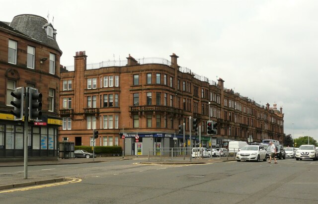
Image: © Richard Sutcliffe Taken: 12 Jul 2021
Anniesland Mansions, a large tenement block with shops dating from 1907-13 and Category B listed http://portal.historicenvironment.scot/designation/LB50011. The block has its largest frontage on Great Western Road, but wraps around Ancaster Drive (seen here); and Crow Road and Willoughby Drive on the far side.
Images are licensed for reuse under creativecommons.org/licenses/by-sa/2.0
Image Location


Leaflet Map data © OpenStreetMap
Latitude
55.889205
Longitude
-4.323387