Glebe Cottage, Wroxeter
Introduction
The photograph on this page of Glebe Cottage, Wroxeter by Richard Law as part of the Geograph project.
The Geograph project started in 2005 with the aim of publishing, organising and preserving representative images for every square kilometre of Great Britain, Ireland and the Isle of Man.

There are currently over 7.5m images from over 14,400 individuals and you can help contribute to the project by visiting https://www.geograph.org.uk
Glebe Cottage, Wroxeter
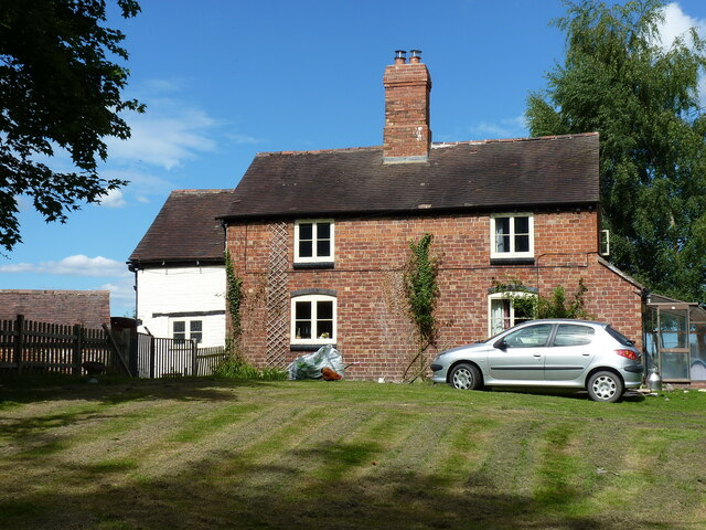
Image: © Richard Law Taken: 12 Jul 2020
To be fair, I missed the important part of this cottage in the photo - the black and white portion at the rear and at the left gable is much older and more interesting than the 18th/19th century brick frontage mostly seen here. The rearwards part dates back to the 15th or 16th century, being interpreted as the remaining fragment of a much larger open hall-house, and built of cruck-frame construction, with a series of period features both internally and externally which give clues to its age and origins. It was Grade II listed https://britishlistedbuildings.co.uk/101224481-glebe-cottage-wroxeter-and-uppington#.YO8Q3uhKjIU & https://historicengland.org.uk/listing/the-list/list-entry/1224481 in 1985.
Images are licensed for reuse under creativecommons.org/licenses/by-sa/2.0
Image Location
Latitude
52.669205
Longitude
-2.646327