Chapel and Castle, Bossiney
Introduction
The photograph on this page of Chapel and Castle, Bossiney by Des Blenkinsopp as part of the Geograph project.
The Geograph project started in 2005 with the aim of publishing, organising and preserving representative images for every square kilometre of Great Britain, Ireland and the Isle of Man.

There are currently over 7.5m images from over 14,400 individuals and you can help contribute to the project by visiting https://www.geograph.org.uk
Chapel and Castle, Bossiney
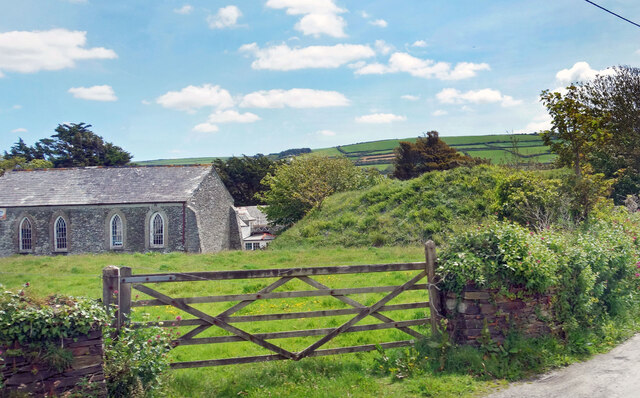
Image: © Des Blenkinsopp Taken: 27 May 2021
The remains of a castle built in the late 11th century which fell into disuse following the building of Tintagel Castle. Not the best picture, I'm afraid, but a chance to include the following extract from the history of the castle on http://www.castlesfortsbattles.co.uk/south_west/bossiney_castle.html "The castle mound continued to be used for a variety of community functions including providing a venue for announcing the results of Parliamentary elections. One such MP returned by Bossiney was Sir Francis Drake who was elected by the borough in November 1584. Bossiney was stripped of its right to send an MP to Parliament by the Reform Act (1832)."
Images are licensed for reuse under creativecommons.org/licenses/by-sa/2.0
Image Location
Latitude
50.666208
Longitude
-4.738502