The Trysting Stone
Introduction
The photograph on this page of The Trysting Stone by Richard Sutcliffe as part of the Geograph project.
The Geograph project started in 2005 with the aim of publishing, organising and preserving representative images for every square kilometre of Great Britain, Ireland and the Isle of Man.

There are currently over 7.5m images from over 14,400 individuals and you can help contribute to the project by visiting https://www.geograph.org.uk
The Trysting Stone
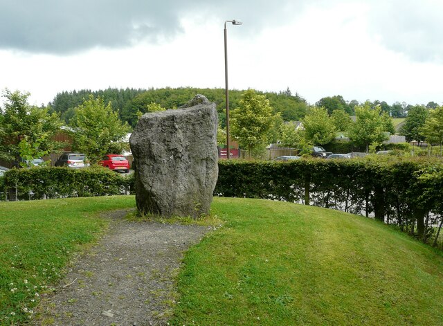
Image: © Richard Sutcliffe Taken: 9 Jul 2021
A large standing stone, situated beside the entrance to Doune Ponds. According to the information board, it was also known by other names: The Deil's Head; The Fairy Stone; and The Goldstone, as well as The Trysting Stone. The latter two are connected to the cattle fairs or 'Trysts', held outside Doune in the 18th century. During the fairs, the stone was used as a counter, where gold was paid for the 'black cattle'. According to Canmore https://canmore.org.uk/site/24761/doune it was 'Traditionally said to have been a Roman Signal stone...' and that it 'rests in the debris of a long-disappeared sawmill beside the railway'. The stone has been moved from its original location and is now about 70m further north. This prersumably happened when new houses were built around about the original location.
Images are licensed for reuse under creativecommons.org/licenses/by-sa/2.0
Image Location
Latitude
56.19242
Longitude
-4.055594