Inverboyndie, Boyndie Bridge
Introduction
The photograph on this page of Inverboyndie, Boyndie Bridge by Mel Towler as part of the Geograph project.
The Geograph project started in 2005 with the aim of publishing, organising and preserving representative images for every square kilometre of Great Britain, Ireland and the Isle of Man.

There are currently over 7.5m images from over 14,400 individuals and you can help contribute to the project by visiting https://www.geograph.org.uk
Inverboyndie, Boyndie Bridge
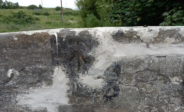
Image: © Mel Towler Taken: 2 Jul 2021
There is a 2nd benchmark on the face of the western parapet. It is a smaller mark and is about 1 to 1.5m to the left of the cut mark on the top of the parapet. It is unusual to find 2 benchmarks on 1 bridge.
Images are licensed for reuse under creativecommons.org/licenses/by-sa/2.0
Image Location
Latitude
57.668516
Longitude
-2.557853