Ladbroke Church and Domesday Plaque
Introduction
The photograph on this page of Ladbroke Church and Domesday Plaque by Stephen McKay as part of the Geograph project.
The Geograph project started in 2005 with the aim of publishing, organising and preserving representative images for every square kilometre of Great Britain, Ireland and the Isle of Man.

There are currently over 7.5m images from over 14,400 individuals and you can help contribute to the project by visiting https://www.geograph.org.uk
Ladbroke Church and Domesday Plaque
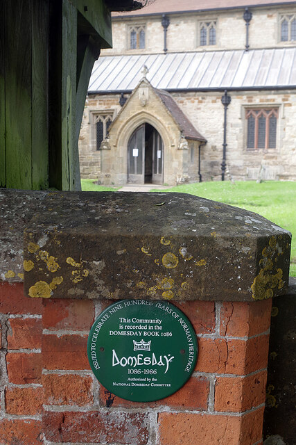
Image: © Stephen McKay Taken: 1 Jul 2021
The green plaque by the lych gate to All Saints' Church was placed here to celebrate 900 years since the Domesday book recorded the existence of 'Lodbroc', named after the Lot Brook. The population then was 252, remarkably similar to the 2011 census figure of 268. In the background is All Saints' Church which was extensively rebuilt in the 14th century. A more modern claim to fame is the connection the village has to the Ladbroke betting shops company (now Ladbrokes Coral) which was founded by a former groom at Ladbroke House.
Images are licensed for reuse under creativecommons.org/licenses/by-sa/2.0
Image Location
Latitude
52.226578
Longitude
-1.396193