Mile Stone on Pont Gareg
Introduction
The photograph on this page of Mile Stone on Pont Gareg by Adrian Dust as part of the Geograph project.
The Geograph project started in 2005 with the aim of publishing, organising and preserving representative images for every square kilometre of Great Britain, Ireland and the Isle of Man.

There are currently over 7.5m images from over 14,400 individuals and you can help contribute to the project by visiting https://www.geograph.org.uk
Mile Stone on Pont Gareg
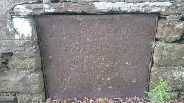
Image: © Adrian Dust Taken: 1 Jul 2021
The Stone states that Pont Gareg was built in 1863 and lists the distances to Cardigan, Aberporth, Newquay & Aberaeron. The Milestone Society records it as: Old waymarker, Pontgarreg This waymarker has elements of a milestone and bridge marker. It is located on an unclassified road between the B4334 & B4321, on the bridge over Nant Hawen (Hawen Brook). The inscription reads:- Pontgarreg / Built 1863 / To Cardigan 12¼ Miles / Aberporth 6 / Newquay 6¼ / Aberayron 12 Milestone Society National ID: CRD_PNG01
Images are licensed for reuse under creativecommons.org/licenses/by-sa/2.0
Image Location
Latitude
52.16016
Longitude
-4.431893