3, Low Pavement, Chesterfield
Introduction
The photograph on this page of 3, Low Pavement, Chesterfield by Alan Murray-Rust as part of the Geograph project.
The Geograph project started in 2005 with the aim of publishing, organising and preserving representative images for every square kilometre of Great Britain, Ireland and the Isle of Man.

There are currently over 7.5m images from over 14,400 individuals and you can help contribute to the project by visiting https://www.geograph.org.uk
3, Low Pavement, Chesterfield
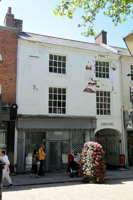
Image: © Alan Murray-Rust Taken: 15 Jun 2021
Town house of c.1800, Listed Grade II. The carriage arch formerly led into a typical long burgage plot yard with multiple dwellings and businesses, originally reaching right down to the River Hipper.
Images are licensed for reuse under creativecommons.org/licenses/by-sa/2.0
Image Location
Latitude
53.23502
Longitude
-1.42795