Canopied tomb in Llandrillo churchyard
Introduction
The photograph on this page of Canopied tomb in Llandrillo churchyard by Richard Law as part of the Geograph project.
The Geograph project started in 2005 with the aim of publishing, organising and preserving representative images for every square kilometre of Great Britain, Ireland and the Isle of Man.

There are currently over 7.5m images from over 14,400 individuals and you can help contribute to the project by visiting https://www.geograph.org.uk
Canopied tomb in Llandrillo churchyard
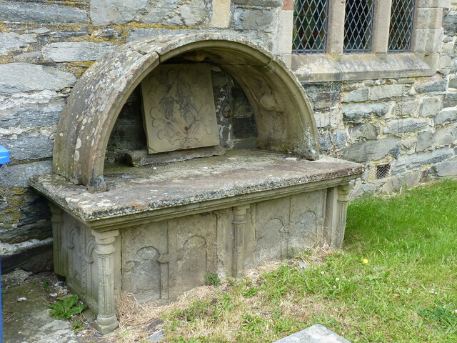
Image: © Richard Law Taken: 27 Jun 2021
This tomb memorial dates from around the early 18th century (one date reads 1706, but much of the inscription is no longer legible) and was erected to the memory of Richard and Katherine Wynne, presumably a local couple who are buried here. It attracted a Grade II listing https://britishlistedbuildings.co.uk/300081880-canopied-tomb-of-richard-and-katherine-wynne-llandrillo#.YNtOIehKjIU in 2003, and is described as "...a fine example of a canopied tomb, a rare memorial type..."
Images are licensed for reuse under creativecommons.org/licenses/by-sa/2.0
Image Location


Leaflet Map data © OpenStreetMap
Latitude
52.922251
Longitude
-3.437764