Roman amphitheatre, Carmarthen
Introduction
The photograph on this page of Roman amphitheatre, Carmarthen by Philip Halling as part of the Geograph project.
The Geograph project started in 2005 with the aim of publishing, organising and preserving representative images for every square kilometre of Great Britain, Ireland and the Isle of Man.

There are currently over 7.5m images from over 14,400 individuals and you can help contribute to the project by visiting https://www.geograph.org.uk
Roman amphitheatre, Carmarthen
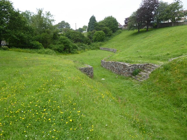
Image: © Philip Halling Taken: 16 Jun 2021
Carmarthen's Roman amphitheatre was excavated in 1968 and 1970 and is an elliptical shape, approximately 90 metres by 60 metres. It is thought to date from around 75AD. The town of Carmarthen was known as 'Moridunum' by the Romans. It is one of two such visible amphitheatres in Wales, the other is at Caerleon.
Images are licensed for reuse under creativecommons.org/licenses/by-sa/2.0
Image Location
Latitude
51.861902
Longitude
-4.296377