Boundary stone, Dove Holes, A6.
Introduction
The photograph on this page of Boundary stone, Dove Holes, A6. by Mr Red as part of the Geograph project.
The Geograph project started in 2005 with the aim of publishing, organising and preserving representative images for every square kilometre of Great Britain, Ireland and the Isle of Man.

There are currently over 7.5m images from over 14,400 individuals and you can help contribute to the project by visiting https://www.geograph.org.uk
Boundary stone, Dove Holes, A6.
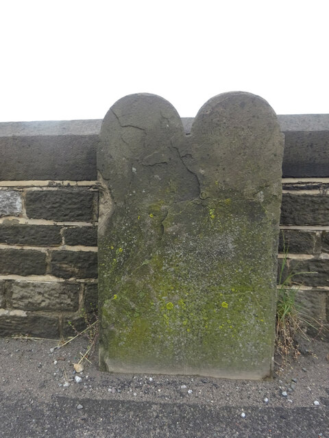
Image: © Mr Red Taken: 24 Jun 2021
The boundary between the Peak Forest and Chapel-en-le-Frith. On the bridge over the disused railway track. Because it is worn, for a typical inscription style see Image (1 km away). Inscription (probably): Town | ships // of // Peak Forest | Chapel-en-le-Frith Milestone Society ID: DE_CHAP02pb
Images are licensed for reuse under creativecommons.org/licenses/by-sa/2.0
Image Location
Latitude
53.306844
Longitude
-1.884211