St Agnes from St Agnes Beacon
Introduction
The photograph on this page of St Agnes from St Agnes Beacon by Tony Atkin as part of the Geograph project.
The Geograph project started in 2005 with the aim of publishing, organising and preserving representative images for every square kilometre of Great Britain, Ireland and the Isle of Man.

There are currently over 7.5m images from over 14,400 individuals and you can help contribute to the project by visiting https://www.geograph.org.uk
St Agnes from St Agnes Beacon
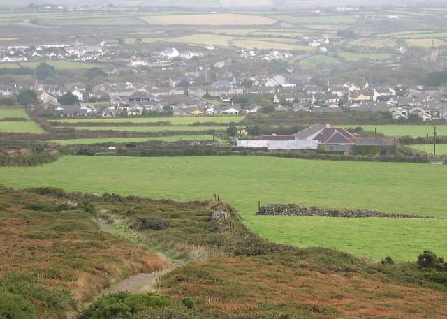
Image: © Tony Atkin Taken: 22 Oct 2005
This photograph was taken from the Trig Point on St Agnes Beacon and looks east over the village of St Agnes. This photograph illustrates the number of 20th century houses which have been built out over the landscape surrounding the mainly 19th century village. Although almost impossible to see on this low resolution version of the photograph there are at least four old mine engine houses scattered amongst the houses.
Images are licensed for reuse under creativecommons.org/licenses/by-sa/2.0
Image Location
Latitude
50.309318
Longitude
-5.204936