High Street, Dunsville
Introduction
The photograph on this page of High Street, Dunsville by Alan Murray-Rust as part of the Geograph project.
The Geograph project started in 2005 with the aim of publishing, organising and preserving representative images for every square kilometre of Great Britain, Ireland and the Isle of Man.

There are currently over 7.5m images from over 14,400 individuals and you can help contribute to the project by visiting https://www.geograph.org.uk
High Street, Dunsville
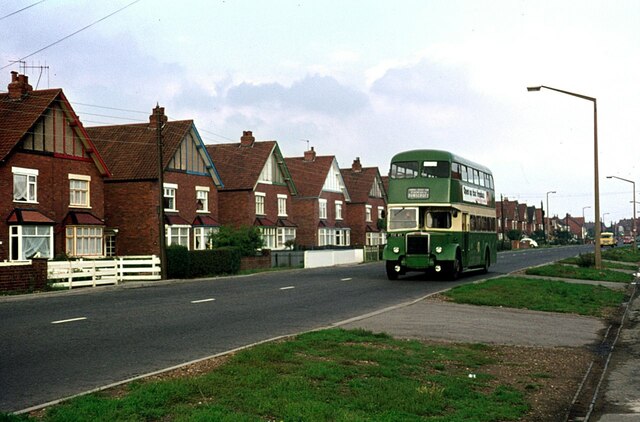
Image: © Alan Murray-Rust Taken: 27 Sep 1976
Housing developed for workers at Hatfield Main Colliery in the late 1930s. The bus belongs the Severns of Dunscroft, one of a number of small bus operators in the area serving the various colliery villages. Not much changed in the next 30 years https://www.geograph.org.uk/photo/372142 . This is one of a series of views featuring buses in the 60s, 70s, and 80s. http://www.geograph.org.uk/search.php?i=137652761
Images are licensed for reuse under creativecommons.org/licenses/by-sa/2.0
Image Location
Latitude
53.561895
Longitude
-1.030412