Easingwold Town Hall
Introduction
The photograph on this page of Easingwold Town Hall by Mel Towler as part of the Geograph project.
The Geograph project started in 2005 with the aim of publishing, organising and preserving representative images for every square kilometre of Great Britain, Ireland and the Isle of Man.

There are currently over 7.5m images from over 14,400 individuals and you can help contribute to the project by visiting https://www.geograph.org.uk
Easingwold Town Hall
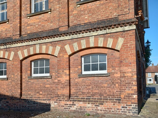
Image: © Mel Towler Taken: 23 Jun 2021
A wider angle of the east facing wall of the Town Hall. On the furthest right of the brickwork, 2 foot from ground level is a benchmark. It is slightly damaged.
Images are licensed for reuse under creativecommons.org/licenses/by-sa/2.0
Image Location
Latitude
54.121985
Longitude
-1.192884