Heathcote Street, Radford, Coventry
Introduction
The photograph on this page of Heathcote Street, Radford, Coventry by A J Paxton as part of the Geograph project.
The Geograph project started in 2005 with the aim of publishing, organising and preserving representative images for every square kilometre of Great Britain, Ireland and the Isle of Man.

There are currently over 7.5m images from over 14,400 individuals and you can help contribute to the project by visiting https://www.geograph.org.uk
Heathcote Street, Radford, Coventry
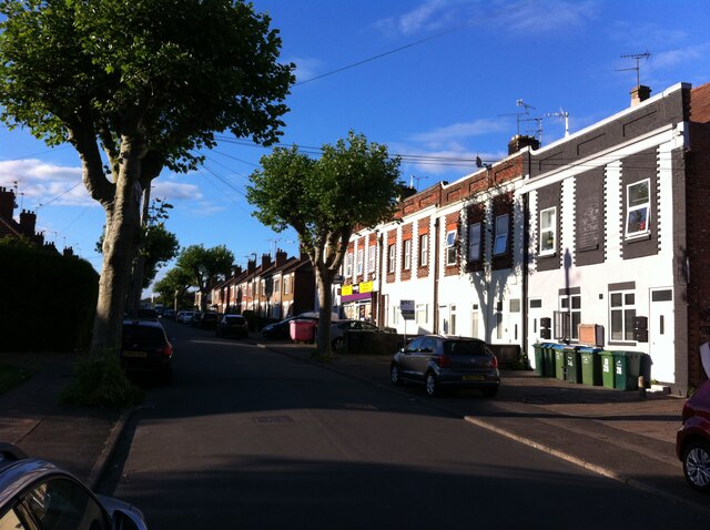
Image: © A J Paxton Taken: 9 Jun 2021
Heathcote Street is a dead end street (though crossed by other roads), but will be familiar to anyone who has attended, or whose children have attended, one of the two primary schools near its far end, Hill Farm and St. Augustine's, a Catholic school. On the right hand side, and extending off the picture into Bulwer Road, are a group of houses whose brick facades have grand 'wild west' parapets concealing the conventional pitched roof behind. The corner house, with its array of wheelie bins, has been executed in blue engineering bricks.
Images are licensed for reuse under creativecommons.org/licenses/by-sa/2.0
Image Location
Latitude
52.42603
Longitude
-1.524653