Listed cottages, Ranscombe Road, Brixham
Introduction
The photograph on this page of Listed cottages, Ranscombe Road, Brixham by Derek Harper as part of the Geograph project.
The Geograph project started in 2005 with the aim of publishing, organising and preserving representative images for every square kilometre of Great Britain, Ireland and the Isle of Man.

There are currently over 7.5m images from over 14,400 individuals and you can help contribute to the project by visiting https://www.geograph.org.uk
Listed cottages, Ranscombe Road, Brixham
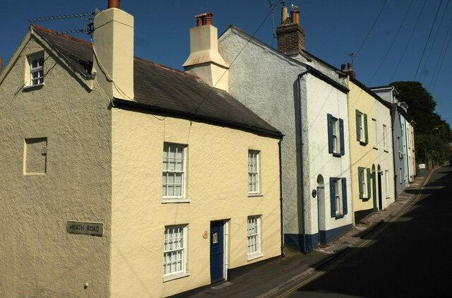
Image: © Derek Harper Taken: 13 Jun 2021
Crabbers Cottage, on the left, is described at https://historicengland.org.uk/listing/the-list/list-entry/1195113. The next three cottages are listed together https://historicengland.org.uk/listing/the-list/list-entry/1218332 the listing includes the following: "In front of the cottages is a pavement of old, worn pebbles with kerb of Devonian limestone blocks". Number 18, beyond these, is one of a listed pair at right angles to the road https://historicengland.org.uk/listing/the-list/list-entry/1195114.
Images are licensed for reuse under creativecommons.org/licenses/by-sa/2.0
Image Location
Latitude
50.396341
Longitude
-3.508317