Cycleway to Malvern Road
Introduction
The photograph on this page of Cycleway to Malvern Road by Peter Whatley as part of the Geograph project.
The Geograph project started in 2005 with the aim of publishing, organising and preserving representative images for every square kilometre of Great Britain, Ireland and the Isle of Man.

There are currently over 7.5m images from over 14,400 individuals and you can help contribute to the project by visiting https://www.geograph.org.uk
Cycleway to Malvern Road
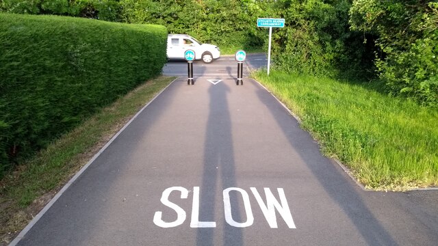
Image: © Peter Whatley Taken: 14 Jun 2021
A purpose built cycle path from Kiln Lane ends with a steep slope down to the busy B4503 (Malvern Road). There is no barrier at the end, so any cyclist misjudging the slope or with inadequate brakes will find themselves in the busy highway. A matter of concern to local residents and councillors alike, but not, at the time of photography, to Worcestershire County Council, the Highway authority.
Images are licensed for reuse under creativecommons.org/licenses/by-sa/2.0
Image Location
Latitude
52.152435
Longitude
-2.320772