The Khyber Pass
Introduction
The photograph on this page of The Khyber Pass by Richard Sutcliffe as part of the Geograph project.
The Geograph project started in 2005 with the aim of publishing, organising and preserving representative images for every square kilometre of Great Britain, Ireland and the Isle of Man.

There are currently over 7.5m images from over 14,400 individuals and you can help contribute to the project by visiting https://www.geograph.org.uk
The Khyber Pass
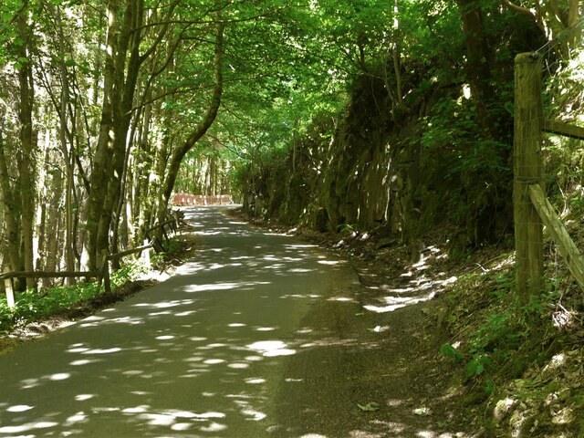
Image: © Richard Sutcliffe Taken: 18 Jun 2021
A steep section of Broadmeadow Road cuts through rocky outcrops along its route. According to the Mugdock Country Park Facebook page: "Originally Craigallian Road ran past the front of Craigallian House and the owners of the estate decided to have it re-routed to give them privacy. The pass through the rocky crag was constructed at the same time as the Khyber Pass Railway Line, on the border of Pakistan, and locals jokingly dubbed the work on Craigallian Estate the "Khyber Pass". The name has stuck to this day!"
Images are licensed for reuse under creativecommons.org/licenses/by-sa/2.0
Image Location
Latitude
55.965512
Longitude
-4.342222