Signpost on the B3139
Introduction
The photograph on this page of Signpost on the B3139 by Neil Owen as part of the Geograph project.
The Geograph project started in 2005 with the aim of publishing, organising and preserving representative images for every square kilometre of Great Britain, Ireland and the Isle of Man.

There are currently over 7.5m images from over 14,400 individuals and you can help contribute to the project by visiting https://www.geograph.org.uk
Signpost on the B3139
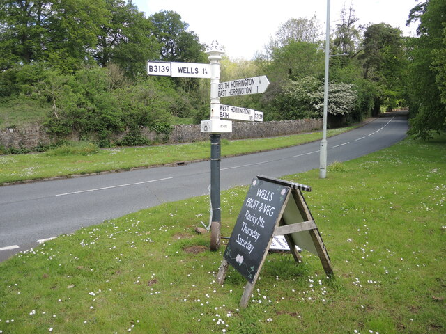
Image: © Neil Owen Taken: 26 May 2021
Just outside the fringes of Wells, the B3139 Bath Road heads up the hill towards the Horringtons. The signpost is a typical Somerset type, but being in the Mendip Hills area it also has a triangular collar below the arms: one side is a graphic, another the name of the place and on the third is a grid reference. See Image The greengrocer's board is an additional item. A couple of odd things is that West Horrington is actually north of South Horrington, and there is no North Horrington.
Images are licensed for reuse under creativecommons.org/licenses/by-sa/2.0
Image Location
Latitude
51.213083
Longitude
-2.621