Footpath crossing of old railway, Upnor
Introduction
The photograph on this page of Footpath crossing of old railway, Upnor by Robin Webster as part of the Geograph project.
The Geograph project started in 2005 with the aim of publishing, organising and preserving representative images for every square kilometre of Great Britain, Ireland and the Isle of Man.

There are currently over 7.5m images from over 14,400 individuals and you can help contribute to the project by visiting https://www.geograph.org.uk
Footpath crossing of old railway, Upnor
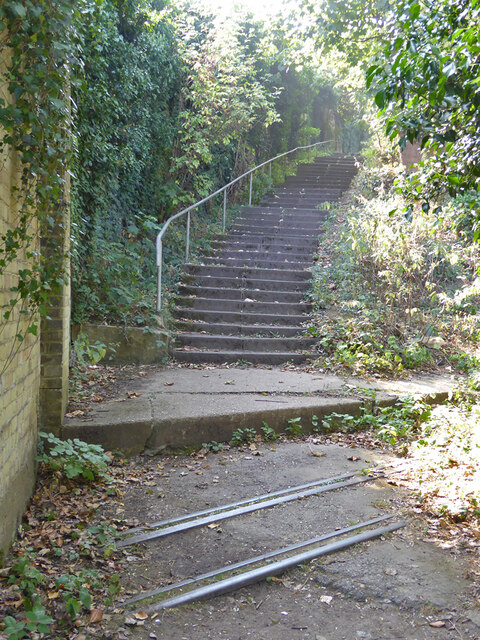
Image: © Robin Webster Taken: 15 Sep 2016
The naval system usually referred to as the Chattenden and Upnor Railway closed fully in 1961. The gauge was 762 mm (2'-6"). Here the gateway into Lower Upnor Ordnance Depot has been bricked up. To the right the line rose at 1 in 23 to a level crossing - Church Crossing - of Upnor Road.
Images are licensed for reuse under creativecommons.org/licenses/by-sa/2.0
Image Location
Latitude
51.409759
Longitude
0.527412