Former Whisky Bond, Trades Lane
Introduction
The photograph on this page of Former Whisky Bond, Trades Lane by Ian Dodds as part of the Geograph project.
The Geograph project started in 2005 with the aim of publishing, organising and preserving representative images for every square kilometre of Great Britain, Ireland and the Isle of Man.

There are currently over 7.5m images from over 14,400 individuals and you can help contribute to the project by visiting https://www.geograph.org.uk
Former Whisky Bond, Trades Lane
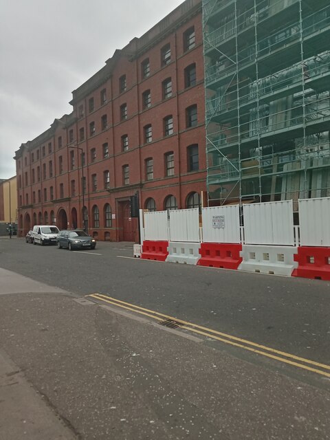
Image: © Ian Dodds Taken: 9 Jun 2021
The building is far more interesting if you wander further down the street and look straight up. For whatever reason this picture doesn't show it at all well, but as you look further up the building, the storeys get shorter and shorter. It was most probably designed like this but when you look up seeing increasingly shorter floors you can't help but wonder if day-to-day finances were impinging on the original design! The building belonged to James Watson Whisky Blenders, and was built after what is said to be Dundee's worst ever fire, which originated in and destroyed the company's original building at this site. The blending stopped in 1981 and the last bottles left in 1987. Eyewitness reports state that there were rivers of whisky, blue and on fire, running down all the streets in this Seagate area, in 1906. The company must have had some cash reserves though, as the new, now listed, building was up and operational by the following year.
Images are licensed for reuse under creativecommons.org/licenses/by-sa/2.0
Image Location
Latitude
56.462965
Longitude
-2.966209