Housing development on site of Coventry Colliery Social Club
Introduction
The photograph on this page of Housing development on site of Coventry Colliery Social Club by A J Paxton as part of the Geograph project.
The Geograph project started in 2005 with the aim of publishing, organising and preserving representative images for every square kilometre of Great Britain, Ireland and the Isle of Man.

There are currently over 7.5m images from over 14,400 individuals and you can help contribute to the project by visiting https://www.geograph.org.uk
Housing development on site of Coventry Colliery Social Club
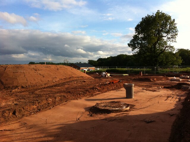
Image: © A J Paxton Taken: 11 Jun 2021
The houses are being built on a strip of land alongside Bennetts Road in Keresley, on the site of the old club, its bowling greens and 5-a-side football pitch. Coventry Colliery Bowls Club has moved further up Bennetts Road North to a site on the rugby club grounds. https://www.coventrytelegraph.net/news/coventry-news/site-former-sports-club-coventry-19254793 The Coventrians football club continues to occupy part of the land between the development and Bunsons Wood. Their clubhouse can be seen in the centre of the picture behind the mound of earth, while players can be seen on the right behind the oak tree.
Images are licensed for reuse under creativecommons.org/licenses/by-sa/2.0
Image Location
Latitude
52.458975
Longitude
-1.535042