The railway seen from Upper Avenue
Introduction
The photograph on this page of The railway seen from Upper Avenue by Marathon as part of the Geograph project.
The Geograph project started in 2005 with the aim of publishing, organising and preserving representative images for every square kilometre of Great Britain, Ireland and the Isle of Man.

There are currently over 7.5m images from over 14,400 individuals and you can help contribute to the project by visiting https://www.geograph.org.uk
The railway seen from Upper Avenue
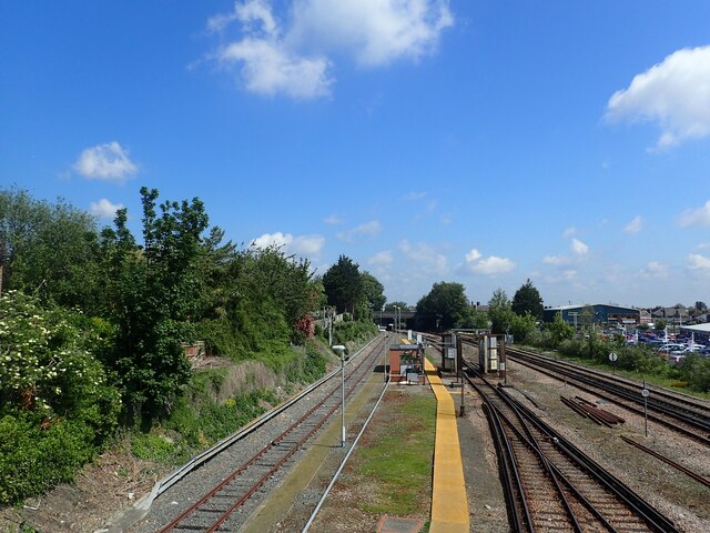
Image: © Marathon Taken: 5 Jun 2021
The single track branch line to Eastbourne from Polegate on the Brighton to Hastings line was opened by the London Brighton & South Coast Railway on 14th May 1849. As Eastbourne’s popularity as a seaside resort grew, two further stations followed: the first in 1866 and the present station in 1886. All train services either terminate at Eastbourne or reverse at the station to continue their journey along the East Coastway to Bexhill, Hastings and Ashford International in one direction or Lewes, Brighton and Victoria in the other. The line along the north side of the triangular junction near Hampden Park which allowed trains to by-pass Eastbourne has now been lifted. This view is from the first overbridge outside Eastbourne station at Upper Avenue.
Images are licensed for reuse under creativecommons.org/licenses/by-sa/2.0
Image Location
Latitude
50.773727
Longitude
0.286863