Former Butchers Arms, Abbotskerswell
Introduction
The photograph on this page of Former Butchers Arms, Abbotskerswell by Derek Harper as part of the Geograph project.
The Geograph project started in 2005 with the aim of publishing, organising and preserving representative images for every square kilometre of Great Britain, Ireland and the Isle of Man.

There are currently over 7.5m images from over 14,400 individuals and you can help contribute to the project by visiting https://www.geograph.org.uk
Former Butchers Arms, Abbotskerswell
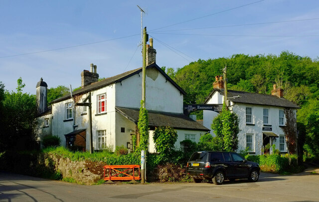
Image: © Derek Harper Taken: 1 Jun 2021
An update to Image and Image "This pub closed c2013 and is to be converted into low cost housing" http://www.closedpubs.co.uk/devon/abbotskerswell_butchers.html . Apart from the sadly dilapidated state of the former pub, the most pronounced change is the ivy on the telegraph poles. On the right is Brook Cottage. The lane to Stoneycombe climbs to the left; Abbotskerswell bridleway 8 heads right along Slade Lane.
Images are licensed for reuse under creativecommons.org/licenses/by-sa/2.0
Image Location
Latitude
50.505493
Longitude
-3.611355