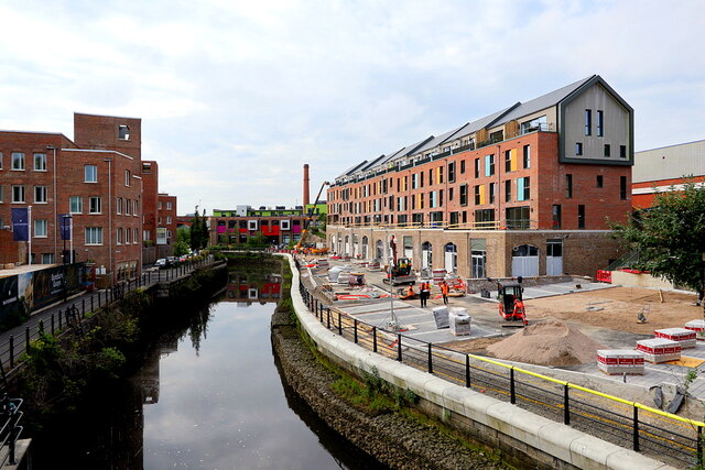
New apartment block, Ouse Street
Introduction
The photograph on this page of New apartment block, Ouse Street by Andrew Curtis as part of the Geograph project.
The Geograph project started in 2005 with the aim of publishing, organising and preserving representative images for every square kilometre of Great Britain, Ireland and the Isle of Man.
There are currently over 7.5m images from over 14,400 individuals and you can help contribute to the project by visiting https://www.geograph.org.uk

Image: © Andrew Curtis Taken: 3 Jun 2021
Housing development of 28 riverside apartments and four new shops or offices at Lower Steenbergs Yard, on Ouse Street in Ouseburn. https://www.chroniclelive.co.uk/news/north-east-news/derelict-land-heart-ouseburn-finally-15527346 https://web.archive.org/web/20210604182533if_/https://www.chroniclelive.co.uk/news/north-east-news/derelict-land-heart-ouseburn-finally-15527346 https://www.chroniclelive.co.uk/news/north-east-news/stunning-pictures-ouseburn-development-newcastle-18809248 https://web.archive.org/web/20210604184020if_/https://www.chroniclelive.co.uk/news/north-east-news/stunning-pictures-ouseburn-development-newcastle-18809248 There was a building here built around 1860. It was possibly the slaughterhouse owned by a Mr Burns. Newcastle Council bought it in 1876 and it is possible that part of it continued as a slaughterhouse, but the main part was a marshalling area for the cattle who had been quarantined for 24 hours in the adjacent Cattle Sanatorium ready for them to be collected by their owners. The Sanatorium became disused from 1900 and the warehouse building was possibly used as a store or sawmill by timber exporters Robson and Miller. On mid C20 maps it is labelled as an oil works (possibly owned by R.M. Rodgers, Oil Merchant from Elswick Court) and warehouse (owned by Steenbergs). The building was demolished in 2000 but part of the rear wall survives covered in white ceramic tiles. The wall fronting onto Ouse Street retains openings which may have been used for pipes for pumping out the finished oil. The oil business ended around 1950. Sitelines: https://sitelines.newcastle.gov.uk/SMR/11743 https://web.archive.org/web/20210604183306/https://sitelines.newcastle.gov.uk/SMR/11743
Image Location


