Chestnut Cottage, Stoneleigh
Introduction
The photograph on this page of Chestnut Cottage, Stoneleigh by Stephen McKay as part of the Geograph project.
The Geograph project started in 2005 with the aim of publishing, organising and preserving representative images for every square kilometre of Great Britain, Ireland and the Isle of Man.

There are currently over 7.5m images from over 14,400 individuals and you can help contribute to the project by visiting https://www.geograph.org.uk
Chestnut Cottage, Stoneleigh
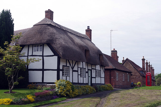
Image: © Stephen McKay Taken: 28 May 2021
Chestnut Cottage, which is thatched and timber-framed with painted brick and plaster infill panels, dates from around 1600. It is grade II listed. Beyond that is a K6 telephone box, now housing a defibrillator, and a row of almshouses.
Images are licensed for reuse under creativecommons.org/licenses/by-sa/2.0
Image Location
Latitude
52.351736
Longitude
-1.515907